


Mercer County PUMA, Pennsylvania
About
Outline

Summary
| Unique Area Identifier | 193848 |
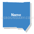
| Name | Mercer County PUMA |
| State | Pennsylvania |
| Area (square miles) | 682.61 |
| Land Area (square miles) | 672.57 |
| Water Area (square miles) | 10.03 |
| % of Land Area | 98.53 |
| % of Water Area | 1.47 |
| Latitude of the Internal Point | 41.30001420 |
| Longtitude of the Internal Point | -80.25278630 |
Maps


Graphs
Select a template below for downloading or customizing gragh for Mercer County PUMA, Pennsylvania


Neighbors
Neighoring Public Use Microdata Area (by Name) Neighboring Public Use Microdata Area on the Map
- Butler County PUMA, PA
- Crawford & Warren Counties PUMA, PA
- Lawrence & Beaver (North) Counties--New Castle City PUMA, PA
- Mahoning County (Northeast)--Youngstown City, Boardman & Austintown PUMA, OH
- Trumbull (Outside Warren City) & Mahoning (Outside Youngstown City) Counties PUMA, OH
- Venango, Jefferson, Clarion & Forest Counties PUMA, PA
Top 10 Neighboring County (by Population) Neighboring County on the Map
- Mahoning County, OH (238,823)
- Trumbull County, OH (210,312)
- Butler County, PA (183,862)
- Mercer County, PA (116,638)
- Lawrence County, PA (91,108)
- Crawford County, PA (88,765)
- Venango County, PA (54,984)
Top 10 Neighboring County Subdivision (by Population) Neighboring County Subdivision on the Map
- Hermitage city, Mercer County, PA (16,220)
- Sharon city, Mercer County, PA (14,038)
- Hubbard township, Trumbull County, OH (13,528)
- Brookfield township, Trumbull County, OH (8,854)
- Grove City borough, Mercer County, PA (8,322)
- Greenville borough, Mercer County, PA (5,919)
- Slippery Rock township, Butler County, PA (5,614)
- Pine township, Mercer County, PA (5,150)
- Farrell city, Mercer County, PA (5,111)
- Sharpsville borough, Mercer County, PA (4,415)
Top 10 Neighboring Place (by Population) Neighboring Place on the Map
- Hermitage city, PA (16,220)
- Sharon city, PA (14,038)
- Grove City borough, PA (8,322)
- Greenville borough, PA (5,919)
- Farrell city, PA (5,111)
- Sharpsville borough, PA (4,415)
- New Wilmington borough, PA (2,466)
- West Hill CDP, OH (2,273)
- Masury CDP, OH (2,064)
- Reynolds Heights CDP, PA (2,061)
Top 10 Neighboring Unified School District (by Population) Neighboring Unified School District on the Map
- Youngstown City School District, OH (69,017)
- Crawford Central School District, PA (30,672)
- Slippery Rock Area School District, PA (20,583)
- Conneaut School District, PA (18,617)
- Grove City Area School District, PA (17,699)
- Franklin Area School District, PA (16,283)
- Hermitage School District, PA (16,220)
- Sharon City School District, PA (14,038)
- Hubbard Exempted Village School District, OH (13,576)
- Wilmington Area School District, PA (11,828)
Top 10 Neighboring State Legislative District Lower Chamber (by Population) Neighboring State Legislative District Lower Chamber on the Map
- State House District 99, OH (108,338)
- State House District 65, OH (102,284)
- State House District 64, OH (101,187)
- State House District 60, OH (95,158)
- State House District 8, PA (62,230)
- State House District 64, PA (59,331)
- State House District 17, PA (58,819)
- State House District 10, PA (58,463)
- State House District 6, PA (58,259)
- State House District 7, PA (56,775)
Top 10 Neighboring State Legislative District Upper Chamber (by Population) Neighboring State Legislative District Upper Chamber on the Map
- State Senate District 33, OH (323,425)
- State Senate District 32, OH (311,809)
- State Senate District 50, PA (235,966)
- State Senate District 21, PA (235,571)
- State Senate District 47, PA (225,797)
Top 10 Neighboring 111th Congressional District (by Population) Neighboring 111th Congressional District on the Map
- Congressional District 5, PA (651,762)
- Congressional District 14, OH (648,128)
- Congressional District 4, PA (647,418)
- Congressional District 3, PA (640,356)
- Congressional District 17, OH (600,111)
Top 10 Neighboring Census Tract (by Population) Neighboring Census Tract on the Map
- Census Tract 325.01, Mercer County, PA (6,214)
- Census Tract 324, Mercer County, PA (6,074)
- Census Tract 328, Mercer County, PA (5,948)
- Census Tract 326.01, Mercer County, PA (5,840)
- Census Tract 2002, Venango County, PA (5,830)
- Census Tract 1113, Crawford County, PA (5,662)
- Census Tract 314, Mercer County, PA (5,399)
- Census Tract 312, Mercer County, PA (5,384)
- Census Tract 320, Mercer County, PA (5,246)
- Census Tract 102.02, Lawrence County, PA (5,185)
Top 10 Neighboring 5-Digit ZIP Code Tabulation Area (by Population) Neighboring 5-Digit ZIP Code Tabulation Area on the Map
- 16125, PA (18,186)
- 16148, PA (16,959)
- 16127, PA (16,145)
- 44425, OH (14,898)
- 16146, PA (14,040)
- 16057, PA (13,909)
- 16137, PA (12,941)
- 16150, PA (7,426)
- 16142, PA (7,056)
- 16314, PA (5,507)